
Spain: The Iberian Peninsula, Meseta & Mountain Systems
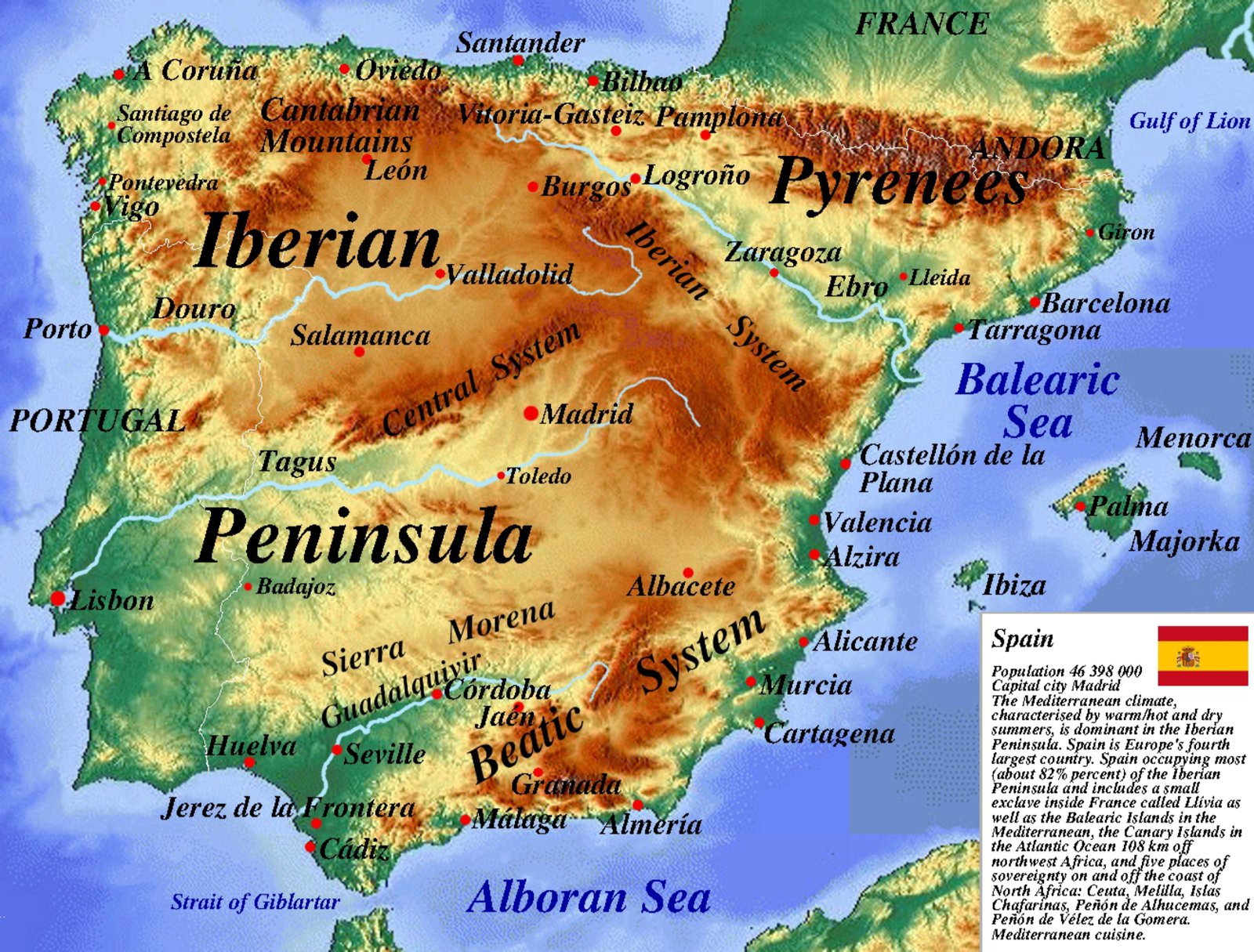
Topography & The Central Meseta
The Iberian landmass is characterized by high average elevation, dominated by the expansive Meseta Central—an elevated plateau divided into northern (Old Castile) and southern (New Castile) sub-plateaus by the Sistema Central mountain range.
Hydrology & Drainage Divides
Due to the westward tilt of the Meseta, the majority of Spain’s major rivers—the Douro, Tagus (Tajo), and Guadiana—flow into the Atlantic Ocean. The prominent exception is the Ebro River, which carves a deep structural depression eastward into the Mediterranean Sea.
Orogenic Features
- The Pyrenees & Cantabrian Range: Continuous northern alpine barrier isolating the peninsula.
- The Betic Cordillera: Southern mountain system hosting Mulhacén (Sierra Nevada), the highest peak on mainland Iberia.
- Sierra Morena & Iberian System: Prominent fault-block rims framing the central tableland.
Beyond the Borders: When Hunger Drives the Outbreak
Maps chart elevations and rivers, but they cannot show the human crises unfolding in remote corners of our world. In isolated areas of eastern DR Congo, medical teams face a critical obstacle: patients are escaping Ebola isolation wards simply because facilities have run out of food.
Why food stops the virus: Strict biosecurity prevents families from bringing meals from home. Without daily hot rations provided inside the center, starving patients flee back to their communities—accelerating transmission.
Learn More & Support on WFP.org »