
Greece: Hellenic Orogeny, Pindus Ranges & Aegean Archipelagos
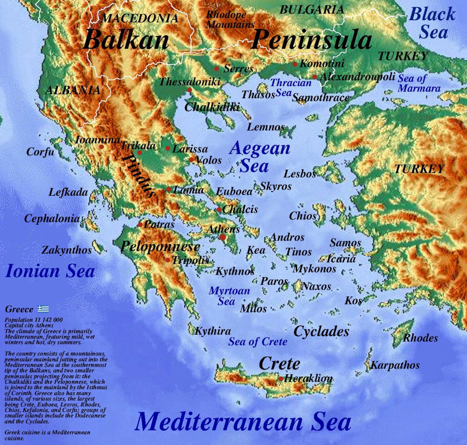
Complex Coastal & Peninsular Topography
Greece occupies the southernmost tip of the Balkan Peninsula, featuring one of the most rugged and fractured relief systems in Europe. Over 80% of the terrain consists of mountainous or hilly terrain, deeply indented by gulfs, straits, and drowned tectonic basins.
The Dinaric-Hellenic Spine
The primary mountain spine—the Pindus Range—extends northwest to southeast across mainland Greece, acting as a continuation of the Dinaric Alps. This ridge terminates in the articulated Peloponnese peninsula and continues geologically as a submerged volcanic arc across Crete and Rhodes.
Key Island Groups & Maritime Basins
- The Aegean Archipelago: Cyclades, Dodecanese, and North Aegean islands representing submerged mountain peaks.
- The Ionian Basin: Western coastal islands marked by deep marine trenches and steep karst cliffs.
- Intramontane Basins: Fertile plains of Thessaly and Central Macedonia supporting regional cultivation.
Beyond the Borders: When Hunger Drives the Outbreak
Maps chart elevations and rivers, but they cannot show the human crises unfolding in remote corners of our world. In isolated areas of eastern DR Congo, medical teams face a critical obstacle: patients are escaping Ebola isolation wards simply because facilities have run out of food.
Why food stops the virus: Strict biosecurity prevents families from bringing meals from home. Without daily hot rations provided inside the center, starving patients flee back to their communities—accelerating transmission.
Learn More & Support on WFP.org »