
Germany: From the North European Plain to the Bavarian Alps
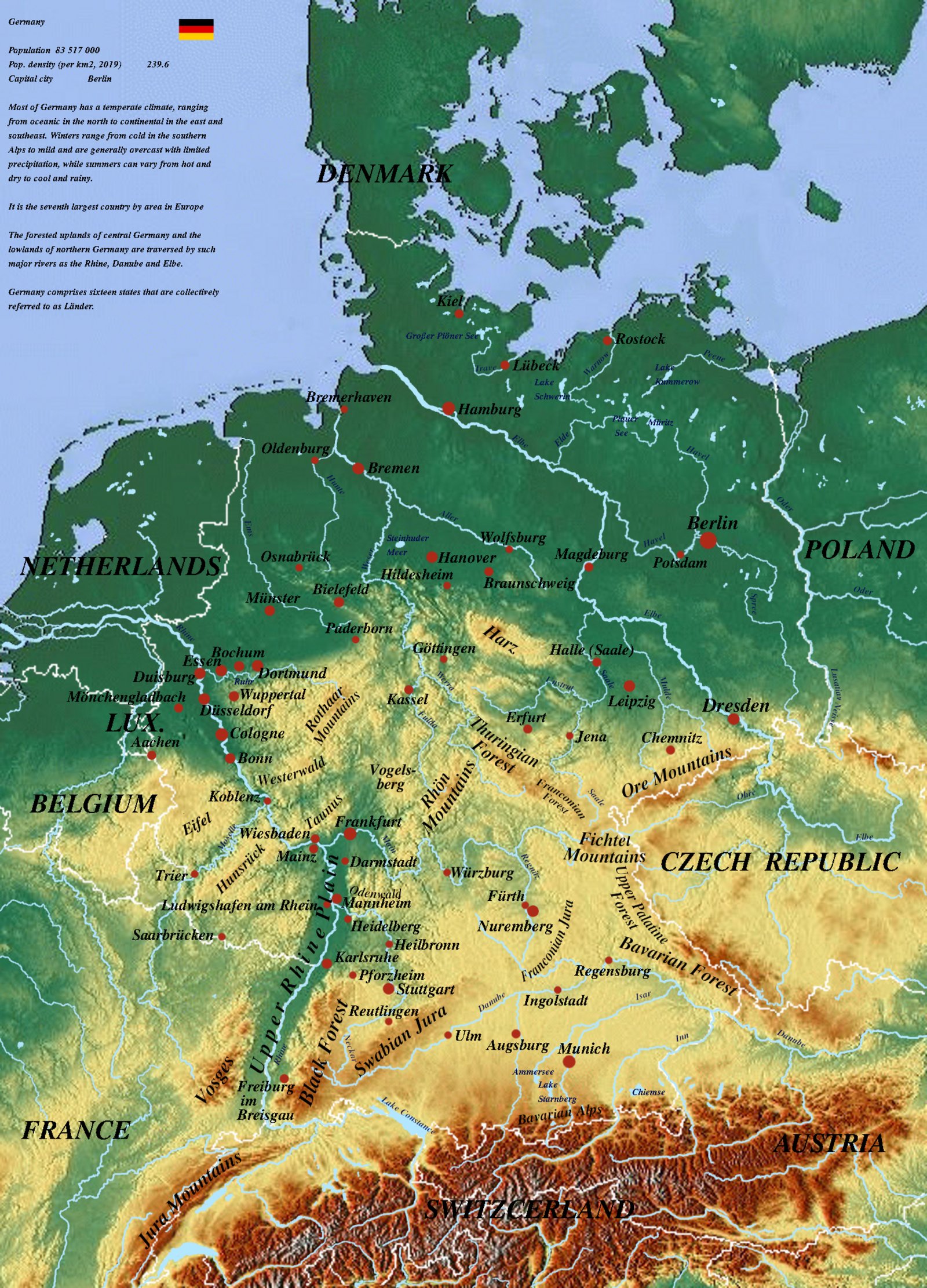
Stepped Hypsometric Profile
Germany’s physical relief descends in a distinct stepped gradient from south to north: from the glaciated limestone peaks of the Alps and the South German Scarplands, through the Central German Uplands (Mittelgebirge), down to the flat glacial topography of the North German Lowland.
Strategic European River Corridors
The Rhine River forms Europe’s most significant commercial water corridor, carving through the Rhenish Slate Mountains. In the east, the Elbe and Oder rivers flow toward the North and Baltic Seas, while the Danube (Donau) rises in the Black Forest and drains eastward into the Black Sea basin.
Dominant Terrain Zones
- North German Plain: Glacial moraines, heathlands, and shallow Baltic lagoons.
- Central Uplands (Mittelgebirge): Harz, Thuringian Forest, Ore Mountains (Erzgebirge), and Black Forest (Schwarzwald).
- Alpine Foreland & Northern Limestone Alps: Plateau gravel sheets, sub-alpine lakes, and the Zugspitze massif.
Beyond the Borders: When Hunger Drives the Outbreak
Maps chart elevations and rivers, but they cannot show the human crises unfolding in remote corners of our world. In isolated areas of eastern DR Congo, medical teams face a critical obstacle: patients are escaping Ebola isolation wards simply because facilities have run out of food.
Why food stops the virus: Strict biosecurity prevents families from bringing meals from home. Without daily hot rations provided inside the center, starving patients flee back to their communities—accelerating transmission.
Learn More & Support on WFP.org »