
France: Topographic Relief, River Basins & Mountain Barriers
Geographical Architecture
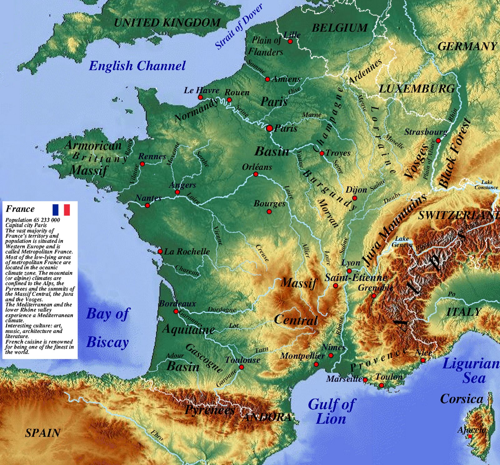
France displays exceptional topographic variety, bridging Atlantic maritime lowlands with high-altitude Alpine and Pyrenean ranges. The ancient Hercynian crystalline core—the Massif Central—anchors the south-central territory, bordered by vast sedimentary basins to the north and southwest.
Principal Drainage Basins
The hydrographic system is organized around four major river networks: the Seine draining the Parisian Basin, the Loire traversing central plateaus, the Garonne draining the Aquitaine Basin, and the Rhône-Saône corridor carving a vital tectonic furrow toward the Mediterranean.
Key Morphological Units
- Sedimentary Basins: Expansive Parisian and Aquitaine basins with gentle cuestas and fertile floodplains.
- Ancient Hercynian Uplands: Armorican Massif, Morvan, Vosges, and the volcanic relief of the Massif Central (Puy de Dôme, Cantal).
- High Alpine & Pyrenean Borders: Glaciated summits including Mont Blanc, forming definitive watershed boundaries.
Beyond the Borders: When Hunger Drives the Outbreak
Maps chart elevations and rivers, but they cannot show the human crises unfolding in remote corners of our world. In isolated areas of eastern DR Congo, medical teams face a critical obstacle: patients are escaping Ebola isolation wards simply because facilities have run out of food.
Why food stops the virus: Strict biosecurity prevents families from bringing meals from home. Without daily hot rations provided inside the center, starving patients flee back to their communities—accelerating transmission.
Learn More & Support on WFP.org »