
United Kingdom: British Isles, Caledonian Highlands & Lowland Scarps
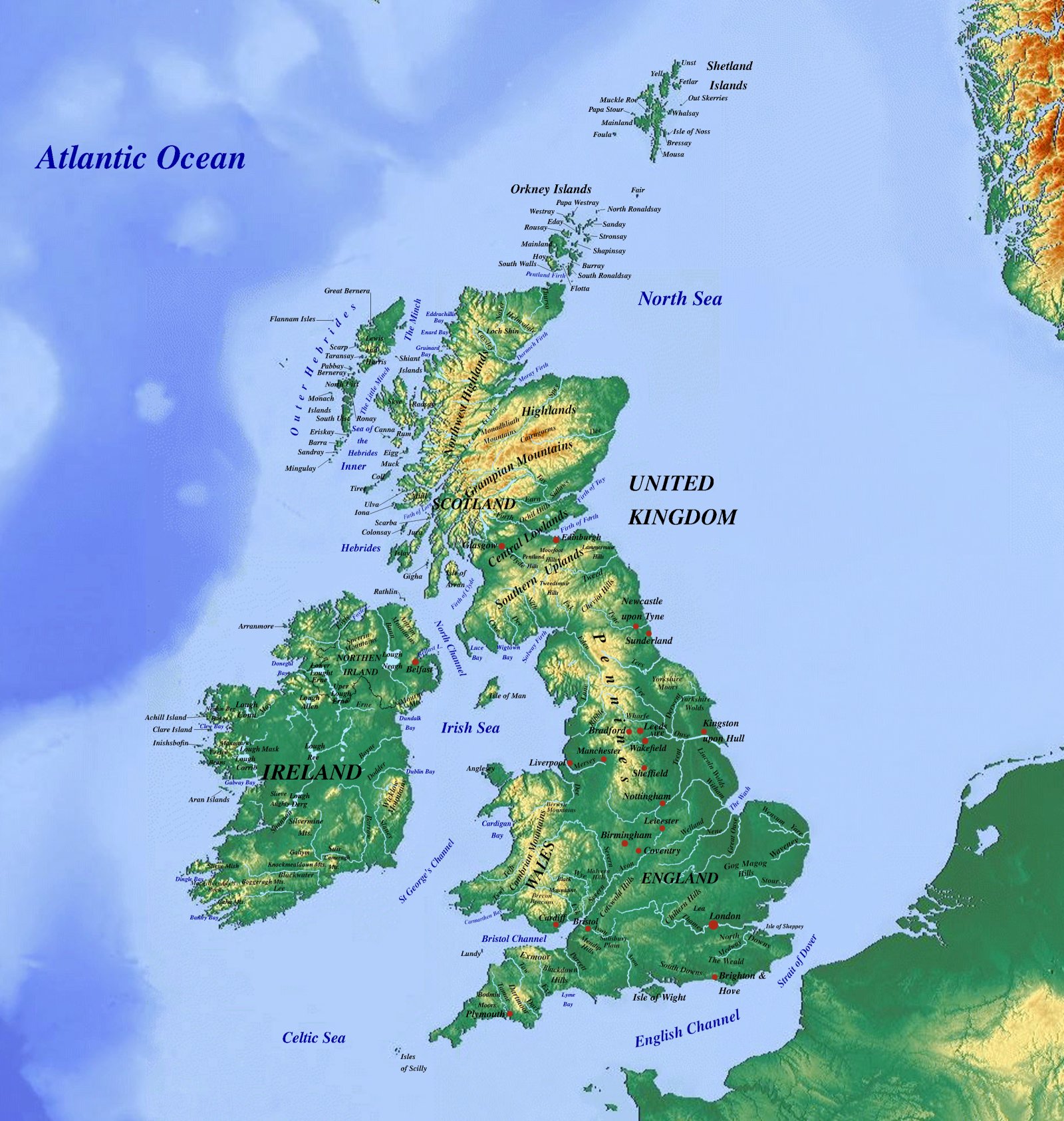
Highland vs. Lowland Division
The physical geography of Great Britain is fundamentally partitioned along the historic Tees-Exe Line. Northwest of this boundary lies Highland Britain, characterized by ancient crystalline and Paleozoic rock massifs. Southeast lies Lowland Britain, dominated by gentler Mesozoic and Cenozoic sedimentary cuestas and clay vales.
Major Orogenic Ranges
The Caledonian and Variscan orogenies shaped the glaciated relief of the Scottish Highlands, the Lake District, and the Cambrian Mountains of Wales. The central spine of northern England is marked by the Pennines, often termed the backbone of England.
Drainage Networks & Estuaries
- Major Estuarine Systems: The Thames Basin, Severn Estuary, Humber, Mersey, and Clyde estuaries.
- Highland Massifs: Grampian Mountains, Northwest Highlands, Southern Uplands, and Snowdonia (Eryri).
- Sedimentary Downlands: The Cotswolds, Chiltern Hills, and the rolling chalk ridges of the North and South Downs.
Beyond the Borders: When Hunger Drives the Outbreak
Maps chart elevations and rivers, but they cannot show the human crises unfolding in remote corners of our world. In isolated areas of eastern DR Congo, medical teams face a critical obstacle: patients are escaping Ebola isolation wards simply because facilities have run out of food.
Why food stops the virus: Strict biosecurity prevents families from bringing meals from home. Without daily hot rations provided inside the center, starving patients flee back to their communities—accelerating transmission.
Learn More & Support on WFP.org »